Trailhead is along the KVR south from Arawana Road, above Lang’s Vinyard at steel gate. If you reach the toilet,
you have gone too far! Pass the gate and follow the clear trail to Scary Rock, a sharp climb. At its top, a trail exits
northeast. Take it for a more challenging hike or ride. Otherwise, continue south until you cross an old graded roadbed and
discover a small marsh area where giant blue marsh grass predominates. Take the left fork. Soon a trail will enter from left.
It is the more challenging route from Scary Rock. Whichever way you got here, go north and follow the trail as it switches
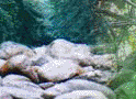
back and climbs. After a short plateau, you turn east and skirt around boulders on a well-constructed trail, ending up on
the power line R-O-W. A hundred meters up-hill, take one of the two trails left and pass through a short dense woods to the
pipe line R-O-W.
A short jog north (left) puts you back on the up-trail. Follow the most-used track across open meadow and up a treed trail
to a rocky plateau. After the basin, turn south on a wider trail. Look to find a huge fallen log with bike ramps. Cross the
log and continue south-southeast to the Lower Cairn.
What to look for
Exhilaration
Great topography, awesome vistas
Wildflowers
A wish to return!
Your trail from Lower Cairn is well traveled and clear. On one expansive granite slab, you will note a trail exit left.
This track avoids a hazard known as the Dropout, which is a sharp drop from the slab to the forest floor below. If
you take the trail left, you will enter a rock garden from which a wide trail leaves to the left. Ignore it and work your
way through the lower rock garden until the trail smoothes out. If you took the Dropout, now take the right track into
the rock garden and turn south and work your way through the lower rock garden until the trail smoothes out. Continue on the
course mainly south, enjoying the terrain. As you approach Turnbull Creek (a bike teeter ramp warns you) turn east (up hill)
and follow the mainly level track to the creek.
Cross Turnbull Creek (it is called Main Crossing by many local bikers) and take the double-track down. If you are
in doubt about the trail, err on the side of staying close to the creek. Soon you will reach a T-junction on the pipeline
R-O-W. Go down the hill and cross the creek, ducking west into the trees promptly on its north side. Skirt along the creek
until you find yourself on the rim of the gully. Follow the trail north through the basin and gently up and across the open
meadow above the gravel pit. Perseverance will bring you to the giant blue marsh grass where you can join your up-trail in
reverse.