|
BL1 Double-track Loop to Blackwells Lagoon
Trailhead: Arawana Forest Service Road, at Kilometer 5.3
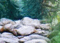
Trail is mostly old logging roads with good walking surface of grass and rocky sand with occasional rough sections, following
the course of Arawana Creek. Look back for great views. The first 2.5 kilometers is gentle to moderate up-hill, with the highest
point the pond itself. This is a good place to stop for a snack and take a wander about.
The return trail takes us past a natural pond with plenty of cattails and marsh life into a mountain meadow where several
trails converge. An old logging road is the return to the trailhead. Total distance is about 7 km. requiring about 2.0 hours
to complete.
BL2 Third-level road to Cows End Loop:
Hike is a mix of single and double track with modest elevation change. The track has both deep forest and open glades.
Good footwear for safety! Side trip is out-and-back to Tripod viewpoint, where there are national survey markers. About 3.0
hours. Trailhead is km 5.3 on Arawana FSR.
BL3 Lady Slipper/Lagoon Loop:
This hike involves a moderately steep uphill through deep forest, a forestry road lateral, then a walk through marshlands
on a good forest track that ends at Blackwell’s Lagoon. An additional 2.5 km. returns us to the trailhead. About 12
km. 3.5 to 4.0 hours. Trailhead is gravel cut above cattle-guard on Arawana FSR.
Tripod Trail
Spectacular hike with great views and steep downs. Links Tripod, Marmot, Rusty Muffler and Cow’s End trails together.
About 8 km or 3 hours. Trailhead is km 5.3 on Arawana Forest Service Road.
This should fill the bill. I have it on my revised summary, which i could send if that would be easier. Phone
if you wish the latter, as I will shut down now for at least 24 hours
Jhuan Trail
Cougars Den Trail:
Hike a short flat lateral to Naramata Canyon. Follow the canyon rim on a steep down trail, then pick up a flat double-track
back to Arawana Road. Hikers must either trek a km up Arawana FSR, or use a shuttle. 1.5 to 2.0 hours for 4 km. Trailhead
is gravel cut at about km. 4 on Arawana FSR, just above the cattle-guard.
Turnbull Creek Top Trail
TC1 Creek up-down.
Trail follows the creek up through dense riparian vegetation with occasional open glades and scenic views. Air here is
cooler. There is one spectacular waterfall, and many wonderful creek views. The loop is about 6 kilometers with some sharp
slopes, so wear good footwear (boots preferred!) About 2.5 hours. Option is to continue farther up to Fred Crossing,
about an additional 3 kilometers and 1 hour. This route opens up several beautiful trails in the Three Blind Mice biking area…
described elsewhere.
TC2 Up-Down Extension.
Trail angles northwest from Fred Crossing, arriving at the Three Blind Mice Main Trail before returning south to Turnbull
Creek. Great scenery. ___ km. About 1.5 to 2 additional hours.
TC3 Turnbull Creek Loop:
Trailhead is KVR above Lang’s Vinyard at steel gate. Trail parallels KVR about 4 km south to Turnbull Creek, then
circles back either along KVR or along pipeline and power line service tracks, as decided beforehand.
This latter route is about half treed and about half exposed to the west along granite slopes with spectacular views. Great
for those cooler days of spring and fall, or early on the hot days. Considerable elevation gain on this route, which is about
2 km longer than the KVR return. On hot mornings, it is better to do the climbing early, then descend and traverse. About
8 km over some rough ground, so wear hikers! About 2.5 to 3 hours.

Above KVR (North of Naramata Canyon)
KVR1 Creek Trail to Horseshoe (Tote) Trail Loop:
This is an ambitious 12 km loop that involves a climb from the KVR low level to the mid-level following Robinson Creek
and the old Irrigation Road. An interesting way-point is the irrigation in-take pond and flume, a great lunch stop in an open
glade in view of a waterfall. After a short walk north on the KVR we descend on the old Tote Road to the Little Tunnel, then
hike 1.5 km back to the trailhead on KVR where it crosses Robinson Creek. Allow 3.5 hours hiking; 2.0 hours on the bikes.
KVR2 Half Creek/Horseshoe:
This is a scaled back version of the hike listed just above. The route proceeds up Creek Trail to the gas pipeline, then
follows that line north at a fairly steep pitch. The Horseshoe is picked up where it crosses the pipeline. Descent is gradual
through forest with occasional open country. The last 150 meters of the Horseshoe is steep. About 5 km or 2 hours.
KVR3 Adra Connector Loop:
Same trailhead as above. Trail climbs to KVR mid-level then follows the railbed south to Adra Tunnel before descending
on old logging road, now pretty well grassed, to rejoin the up-trail at the power line. Very scenic, but has considerable
elevation gain. Good footwear required. About 12 km. or 3.5 hours.
EASIER OPTION: Use trailhead at KVR mid-level
where it crosses Robinson Creek. Descend the old irrigation road, then regain altitude on the Connector to the Big Tunnel,
the return to vehicles on the KVR track, or use a shuttle. About 8 km or 2 to 3 hours.
KVR4 Stationmasters Loop:
Trailhead is near 3 km point on Naramata Forest Service Road. After a short, sharp climb to Adra Tunnel, the trail continues
above the tunnel and heads down-hill to the abandoned Adra Station, then follows the KVR roadbed back to the south entrance
to the tunnel. Sidetrips include the north tunnel entrance where it is safe to follow the tunnel in to the ventilation hole
and, to the ventilation hole above the tunnel. 2 hours.
Three Blind Mice Bike Trails
TBM1 Bull Run (Pass) Loop:
Trailhead is KVR above Lang’s Vinyard at steel gate. Trail climbs sharply to gas pipeline, then heads south before
turning back on itself. A variety of alternate trails mean that the return track is different terrain for the most part. About
6 km over moderately rough ground. 2.5 hours.
TBM2 Lower Cairn Loop:
Trailhead is KVR above Lang’s Vinyard at steel gate or at KVR where it crosses Turnbull Creek, as
decided beforehand. Car shuttle required. This is an extension of the Bull Pass Loop and joins the Turnbull up-down Loop
after a traverse of the main trail in the 3-blind-mice network. There is additional climbing here, but the views and the sense
of accomplishment are worth the time and effort. Once you are here, a whole new world of trails presents itself. As many folks
ride bikes in this area, it is safe, and advice is often available. About 12 km or 3.5 hours with lots of climbing and equal
descent.
TBM3 Fenceline to Bobcat down trail:
Trailhead is cattleguard at approx. Km 4 on Arawana Forest Service Road. A short lateral takes us across Arawana Creek
before a sharp but well-groomed trail descends to intersect with the Bobcat trail. Here, we take a side-trip to the Ashtray
viewpoint before heading back down a good trail with a few steep pitches. Egress is steel gate on KVR above Lang Vinyards.
About 8 km with almost no up sections. About 2.5 hours depending on time at the Ashtray. Shuttle required.
TBM4 Rusty Muffler down trail:
Gentle downhill trail with good footing for the most part. Nice mix of trees and open country. Short side trip to Upper
Cairn, a good spot for lunch. We continue down to Fred (trail is rougher here) where we may choose egress by either Bull Pass
or Turnbull Creek as decided beforehand. About 12 km mostly downhill. Allow about 3 hours from trailhead.
Shuttle required.
TBM5 Bobcat up-down:
From the high point on the Bull Pass Loop, we continue on upward to the east, then steer north along a clear track with
gentler pitch through beautiful, moderately treed country. A final steep pitch brings us to a fantastic viewpoint known to
local cyclists as the Ashtray. Lunch time, before a descent utilizing alternate track we observed on the way up. Like
the (upper) Turnbull Loop, this hike is worth the effort expended to reach the top. There are many trails down and away from
the Ashtray, but selection of any of these creates new hikes, listed below as 6 and 7. About 10 km or 3+ hours.
TBM6 Bobcat to Fred Crossing, return via Turnbull Creek:
Fred is a well-developed trail that permits a (more-or-less) level traverse from north to south. 4+ hours. Shuttle required
unless egress is across Turnbull Loop low trail from the creek.
TBM7 Naria to Main trail, return via Bull Pass.
The trail is a bit rough, but has beautiful scenery, dense scrub forest and open vistas, so worth a bit of downhill slogging!
3+ hours
Uplands Trails
(Warning: Mosquito encounters!)
UL1 OK Mountain Park viewpoint trail:
About 3 km in the burned area with moderate climb on the way to the viewpoint. Trailhead is Park parking lot off of Chute
Lake Road, well signed. 1.5 hours.
UL2 Gemil Lake trail:
Moderate up-trail through burned area to a small marsh tucked in beside the power line. 3.0 hours. Trailhead is Park
parking lot off Chute Lake Road, well signed.
UL3 Woodwackers trail(s):
Trailhead is tower road about a kilometer past the cattleguard at the top of the hill on Chute Lake Road. This gently
sloping track is both scenic and historic leading about 4.0 km to an intersection with the Woodwacker trail dedicated to Ted
and Jean Smith. Rougher footing near the south end. (Access to KVR here if shorter hike is preferred.) The other part of the
trail, called the Ted-and-Jeanie locally, is a rehabilitated section of the old tote road that linked construction
camps along the upper level. It is a traverse mostly within earshot of the KVR, but offering fine vistas, interesting terrain
and active riding for cyclists. 4.0 km ending at a picnic site with toilet. This trail is worth hiking both ways. Trail is
marked with a sign erected by the Woodwhackers. 2.5 to 3 hours when using vehicle shuttle; 5 hours if returning by KVR.
UL4 Three lake out-and-back:
Eleanor Lake FSR gently climbs to Eleanor and Naramata lakes, with return the same way. Local exploration opportunity.
3 to 4 hours.
UL5 Chute-Eleanor-Diversion Loop:
Trail climbs gently on FSR and turns north at Eleanor Lake, then follows an irrigation double-track to the concrete diversion.
Trail crosses Chute Creek to the FSR leading back to Chute Lake, mostly a gentle descent. 3+ hours.
UL6 Bellevue Canyon and Trestle:
By vehicle from Chute Lake west about 16 km on rough track, the KVR. Hikers can drive right to this trestle, at 238 meters,
the longest on the Midway to Penticton section of the KVR, and about 55 m high. It is a fine example of a curving steel bridge
of the 1930’s era, and is decked and hand-railed for safety. There is usually access to below the bridge for photos
and to satisfy curiosity. Excellent views of the shoulder of Little White Mountain. Reread parts of Barrie Sanford’s
excellent book, McCullough’s Wonder, for information on the skill of the chief engineer, and a rationale for
the route selected.
UL7 Big Meadow exploration:
Big Meadow, the highest lake on Naramata’s former irrigation system, may be reached from either Arawana Road or
via Chute Lake. A well-defined double-track is cut part way around the lake, and joins the Okanagan Highlands Trail, which
leads to Corporation Lake and Little White Mountain. Hikes are short, but the area is quite beautiful. Mosquitos here bite
all summer long! Drive is about 1.0 hours each way. One hike, through scrub forest on a well-defined trail, leads to Corporation
Lake, which was once the highest lake on Penticton’s Greyback watershed. Return time:: 2.0 hours!
|