This is
one of those rides/hikes where the journey is the destination.
What to look for
·
Great views
·
Sweeing downhills
·
Mix of open land
and dense forest
·
Vegetaion change
with elevation change |
This is
one of those rides/hikes where the journey is the destination.
What to look for
·
Great views
·
Sweeping downhills
·
Mix of open land
and dense forest
·
Vegetation change
with elevation change
·
Flowers, Deer,
Elk |
Trailhead is at the cattle-guard
on Arawana FSR about KM. 5. Head south along a clear trail until you reach the
fence. Here, duck right off the double-track and find the single-track that runs
along the fence on its west side. Soon you will enter a gully formed by Arawana
Creek. Cross with care and continue south along the fairly flat pathway. You will enter a double-track briefly, and will note a trail exit west and descend. Follow that trail through its steep descent until the trail narrows and other trails
appear. Select the track headed south and follow until it intersects with others
in a shallow and wooded basin. Select the trail headed southwest up a rough and
steep hillside, noting that there is open country beyond a narrow band of trees. As
the pitch eases, take the right (north) track at the T-junction and climb to the nearby lookout.
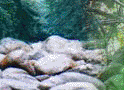
This elevated rock outcrop is locally called the Ashtray,
while the trail network in the basin is known as the Lookout Loops. Enjoy the spectacular view before heading north off the lookout.
Follow the trail north up a slight rise, selecting either trail at the Y, as they converge soon as the trail adopts
a more northeast direction before descending to a switch-back to southwest and descends further. You will now encounter a variety of trails that branch and converge as the land rolls off to the southwest. You cannot go far wrong in following any of these through the (generally) open forest. Trails finally bring you to a large Ponderosa pine tree that has fallen in recent
years, and a single trail continue down from there.
You will go over several small drop-offs and cross a rocky draw before your trail becomes more southerly,
with obstacles more frequent. A major trail enters from the left, and you soon
reach an open and sloping plateau where your trail dead-ends on a cross-trail. Turn
south and begin to descend in about 100 meters. Stay with this track until you
spot the red-and-white marker of the pipeline. A short jog south (say 10-15 meters)
your trail resumes westward through trees, bringing you onto the power R-O-W. Head
downhill and take the single-track west just before the outrageous climb. Stay
on this track until it switches-back in the Ponderosa parkland. The next trail
west will take you over a rocky outcrop to Scary Rock. Follow the trail off this
rock to the northwest, pass by the steel gate and arrive at the KVR. Proceed
to your ferry point.