Trailhead is marked by a rusty muffler perched atop a rock on the west shoulder of Arawana FSR, just above km 4. There
is good parking at the gravel cut about 150 m. below.
What to look for
Vistas
Fun trails
Varied vegetation
Deer, snakes
Do this hike or bike just for good fun!
Follow this clearly marked and well-used track gently downhill through mostly open forest. Ignore the various side trails
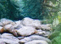
until you end up on a broad open slope with lots of exposed granite. ( about ___ min hiking’ ___ min on the bike. It
is quite a ways, so be patient.) Watch for a fairly tall cairn beside the trail. Stop here. This is Upper Cairn, a
navigation point for mountain bikers. A short lateral to your south links up with Riddle FSR, a very rough road.
Retrace your steps to the first intersection just inside the trees, and head downhill on the Mule Deer trail. This
track soon comes to an end at T-junction with a main north-south trail called Fred. Turn right (north) and pass over
the Sidewalk, a trail-builders’ achievement. Continue north until you encounter several trails converging in
a confined space. These are the Lookout Loops, and herald a great viewpoint, the Ashtray, so named for the elevated
fire "pit."
Exit the Ashtray the way you came in, but do not reenter the draw where you encountered the Loops. Enjoy
the fine views as you descend. Back in the forest, keep a lookout for the Y-junction. The right fork is 3-Witches, a hairy
descent with easy-outs for tamer riders and hikers. Maybe next time! Take the left fork on to Narnia. This is
a great descent, so just enjoy the ride or hike. Eventually you will enter a draw via a steep trail in thick but small trees,
and reach a cross trail. The sharp climb to your left is the Dropout, a scramble for hikers, but a major challenge
for the 2-wheeled crowd. (Alternate route is ahead and northwest through a short rock garden, then across the granite to rejoin
the trail.) Continue north and gently uphill to the cairn, called Lower Cairn. Signs point out other trails. Head for
the Bobcat, over the big log, then west through the basin and on down.
Jog south (left) at the pipeline, and enter the trees, until you dead-end on the power line. Turn north through
a draw, then sharply west at the base of a huge climb. This is Bull Pass. Continue down, bearing north and west. Take
the switch-back at the end of a traverse, and follow the next trail left (west) over a granite mound with great views. You
will run out of trail at Scary Rock, where you descend and make your way via the steel gate to the KVR.