What to look for
Open Ponderosa parkland
A protected draw where elk and deer winter
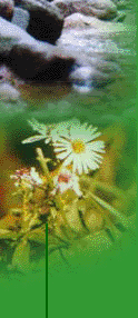
Wildflowers of streambeds and open forest. Foxglove at the culvert.
View at the power line showing topography and the KVR
Two ponds
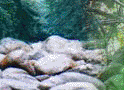
Rock Ovens
The bear tree
The Little Tunnel
KVR construction features
From trailhead at Smethurst Road parking lot on the KVR, proceed north along the railbed about 2.5 km. until you cross
the deep fill at Robinson Creek. Turn up the trail along the creek. Follow it up along the creek and turn sharply at the end
of the fence. About 50 meters on, the trail is vague, but turns southeast along an old cut road, becoming well-defined along
a fence line. This trail breaks out onto the gas-line right-of-way where the creek flows through a culvert.
Stand on the culvert and look south. A trail heads down the bank to your right. Follow it as it turns south and heads up
a long steady climb. At the top of that climb, the trail is again vague. It heads off south before regaining definition. Off
to your left you will spot an excavation. Bear east into the gully and climb the track that heads south again. Soon you will
see the power line. Stay on the track that leads to the towers, then turn sharp left at the fence. This track is the irrigation
service road.
After a short climb, enjoy the descent in open forest. As the road resumes a fairly sharp ascent, you will spot a double-track
that takes off to the left (north) leading to the irrigation system intake. In the glade about a half-km away is a man-made
pond and natural waterfall. Enjoy. A short walk downstream reveals the flume that carries water to its intake farther down
the hillside.
Back on the irrigation road, there is a rough ascent, but it is only a km or so before the road dead-ends on the mid-level
of the KVR. (This is Ray Ward’s summer camp while he maintains the KVR. Stop and say hello if he is about.) Turn north
on the KVR for less than a kilometer. A clear Woodwacker’s sign marks the Horseshoe (Tote) Trail. The descent is a bit
steep at first, but can be ridden with care, coming out on the gas-line right-of-way again. Follow the signage, eventually
crossing the power line and descending into woodlands again. Enjoy. The last steep descent after passing the rock ovens (and
an inviting pond, usually wet all season) brings you back to the KVR just south of the Little Tunnel. Visit the tunnel, or
return to trailhead.